Free Maps of Iran
Download five maps of Iran for free on this page. The maps are provided under a Creative Commons (CC-BY 4.0) license. Use the "Download" button to get the largest image available.
| Informations of Iran | |
|---|---|
| Name | Islamic Republic of Iran |
| Capital | Tehran |
| National holiday | Republic Day, 1 April (1979) |
| Population | 86,758,304 |
| Continent | Asia |
| Subregion | Southern Asia |
| Border countries | Afghanistan 921 km; Armenia 44 km; Azerbaijan 689 km; Iraq 1,599 km; Pakistan 959 km; Turkey 534 km; Turkmenistan 1,148 km |
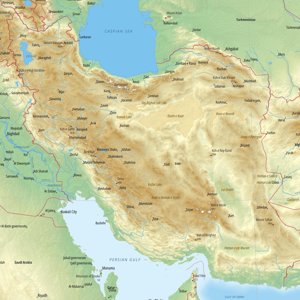
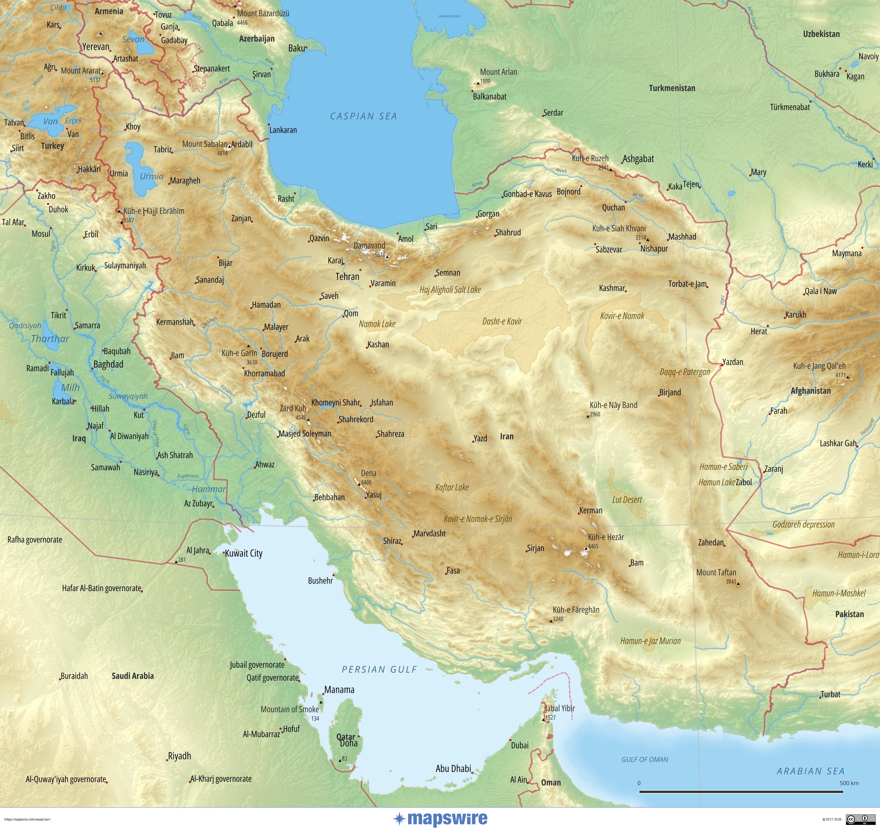
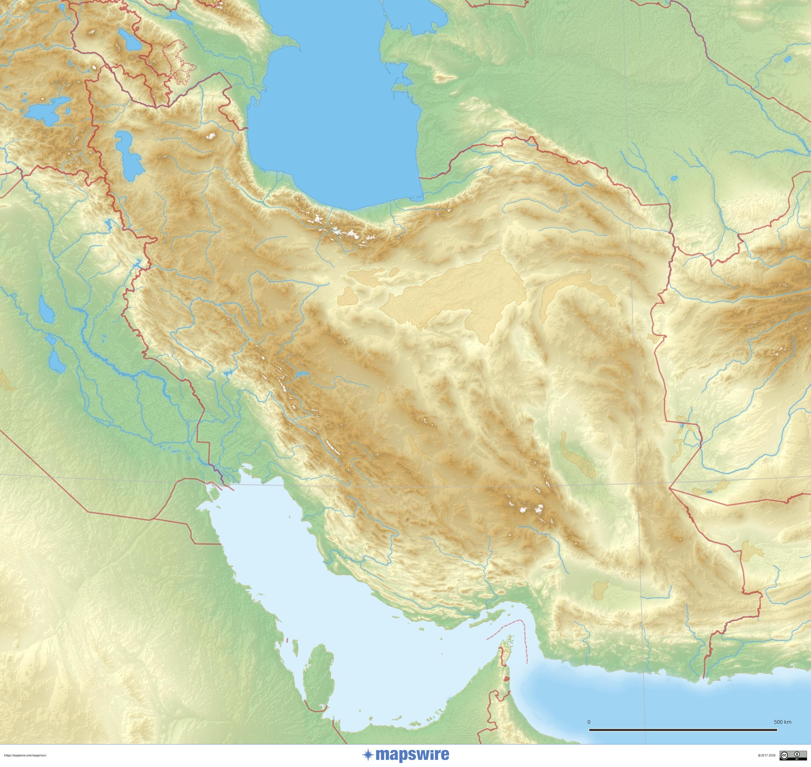
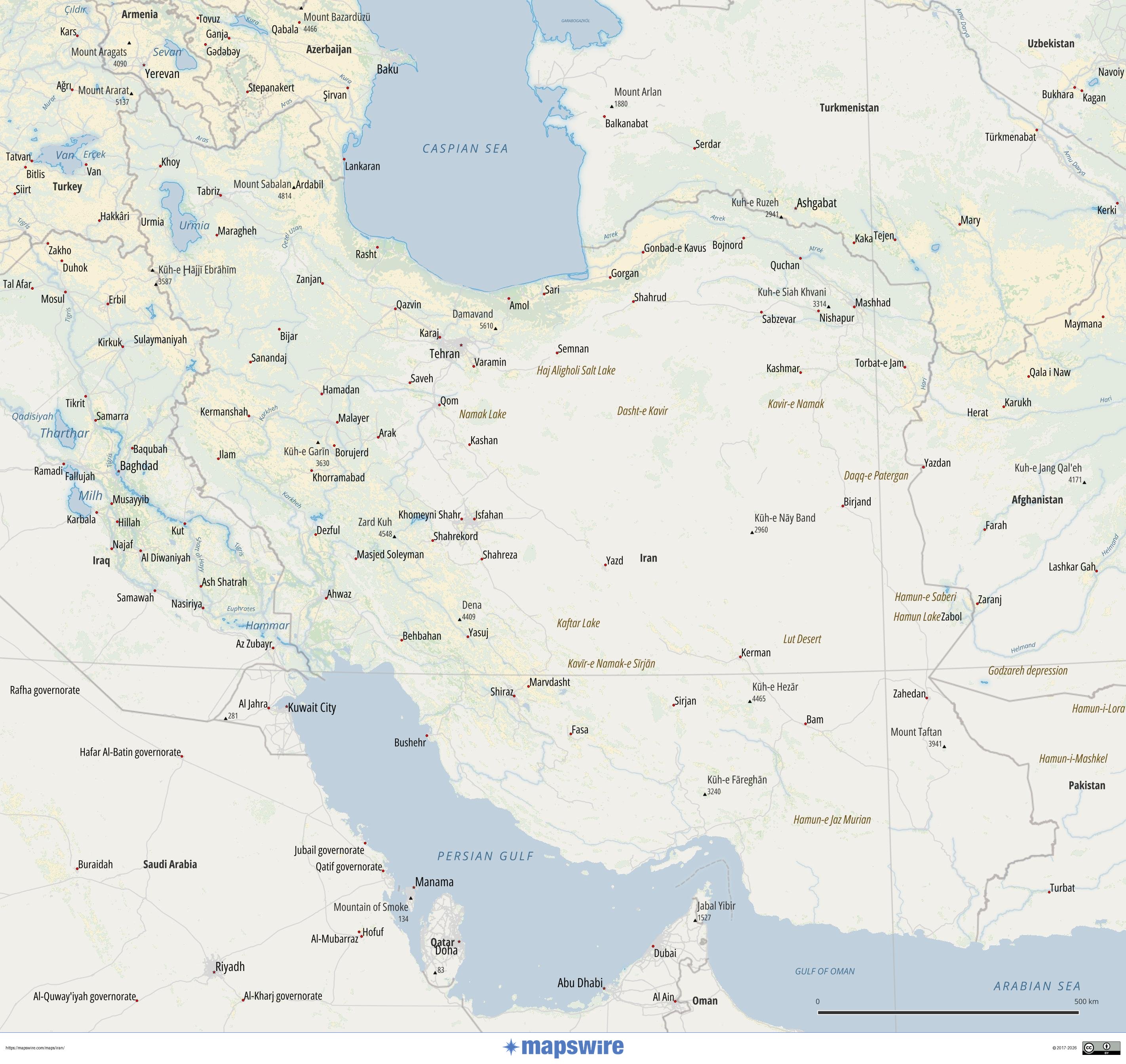
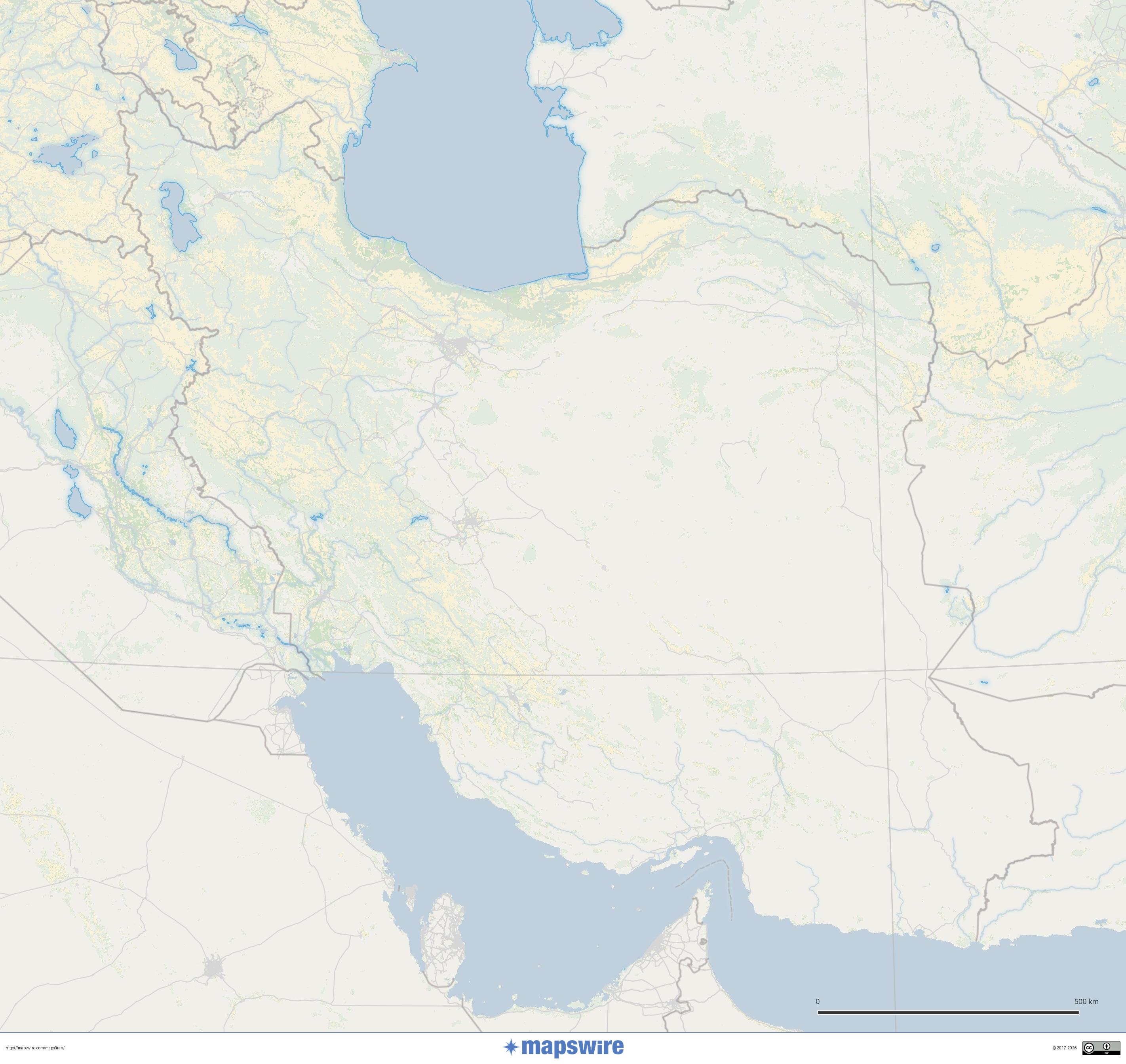
Physical Maps of Iran
Landcover Maps of Iran
Where is Iran located?
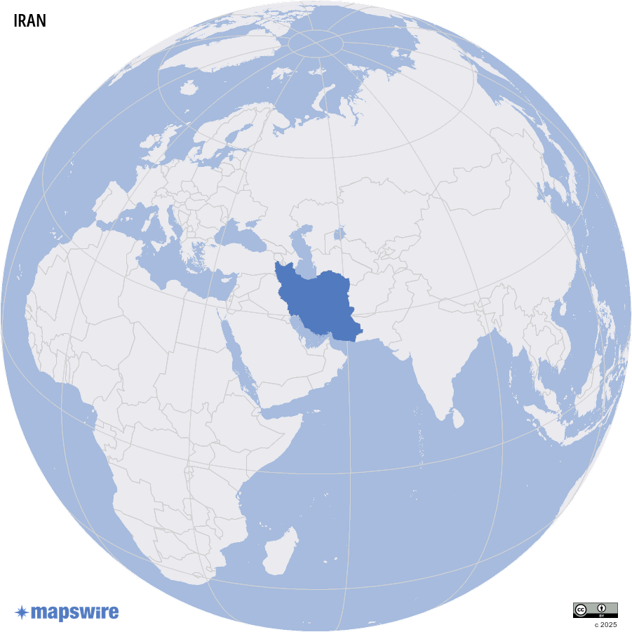
Location
Middle East, bordering the Gulf of Oman, the Persian Gulf, and the Caspian Sea, between Iraq and Pakistan
DownloadGeography of Iran
Major Mountain Ranges
Iran's geography is dominated by towering mountain ranges. The Zagros Mountains, forming a vast arc across western and southwestern Iran, are the country’s longest and most significant range. These mountains are particularly important historically and are home to numerous ancient sites. The Alborz Mountains, running along the northern edge of the country, are considerably younger and more rugged, featuring Iran's highest peak, Mount Damavand. This stratovolcano, located near Tehran, rises to 5,610 meters (18,406 feet). Finally, the Eastern Iranian Ranges stretch across the border regions, forming a significant mountain barrier between the plateau and the lowlands of the east.
Rivers and Waterways
While Iran is a dry country, several rivers carve their way across the landscape. The Arvand Rud (known internationally as the Shatt al-Arab), formed by the confluence of the Tigris and Euphrates, marks the border with Iraq and flows into the Persian Gulf. The Karun River, Iran's most voluminous and only navigable river entirely within the country, originates in the Zagros Mountains and is a major tributary to the Arvand Rud. The Zayandeh Rud, in central Iran, is notable for nourishing the Isfahan region, despite facing severe water scarcity challenges. The Sefid Rud, located in northern Iran, is the country's second-longest river and is known for its high hydroelectric potential.
The Strait of Hormuz: A Global Chokepoint
Connecting the Persian Gulf to the Gulf of Oman and the Arabian Sea, the Strait of Hormuz is arguably the most strategically important maritime passage in the world. At its narrowest point, the strait is only about 33 kilometers (21 miles) wide, with shipping lanes just 3 kilometers (2 miles) wide in either direction.
Its importance to the global economy is immense:
- Oil Volume: Approximately 20% of the world’s daily oil consumption (roughly 20 million barrels per day) passes through this narrow gap.
- LNG Trade: It also facilitates about 20% of the global liquefied natural gas (LNG) trade, primarily originating from Qatar.
- Economic Impact: Because there are few viable land-based alternatives for transporting these volumes, any disruption here can lead to immediate spikes in global energy prices and supply chain volatility.
Plateaus and Plains
The dominant feature of Iran’s topography is the Iranian Plateau, a vast elevated expanse covering most of the country with an average elevation of around 1,200 meters (3,937 feet). Within this plateau lie two massive deserts. The Dasht-e Kavir (Great Salt Desert) is a large arid expanse in central Iran characterized by salt crusts. The Dasht-e Lut, located further east, is even more extreme and holds records for some of the highest surface temperatures ever recorded on Earth. To the northwest of Tehran lies the Qazvin Plain, a vital and fertile agricultural area.
Coastlines and Islands
Iran boasts extensive coastlines along two major maritime regions. The Caspian Sea coastline in the north is characterized by sandy beaches and lush forests, while the southern coastline borders the Persian Gulf and the Sea of Oman. The Persian Gulf is dotted with numerous islands, including Qeshm Island, the largest in the gulf, renowned for its unique biodiversity. Other notable islands include Kish Island, a major commercial hub, and Kharg and Hormoz Islands, which hold significant strategic and economic value for the petroleum industry.
Lakes
Iran contains several significant lakes, many of which are endorheic. Lake Urmia, in northwestern Iran, was once the largest lake in the Middle East, but it has faced a dramatic ecological crisis as its water levels have severely receded. Lake Bakhtegan, in the south, was a salt lake highly sensitive to seasonal rainfall and is now completely dry. In the southeast, Lake Hamun represents a vital wetland ecosystem on the border with Afghanistan, though it frequently struggles with drought and upstream water management.