Get a new map every two weeks! Subscriber to the newsletter and get a new map every two weeks!

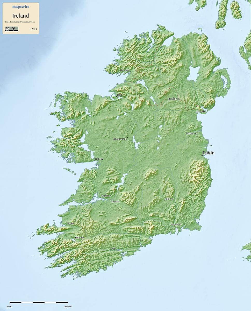
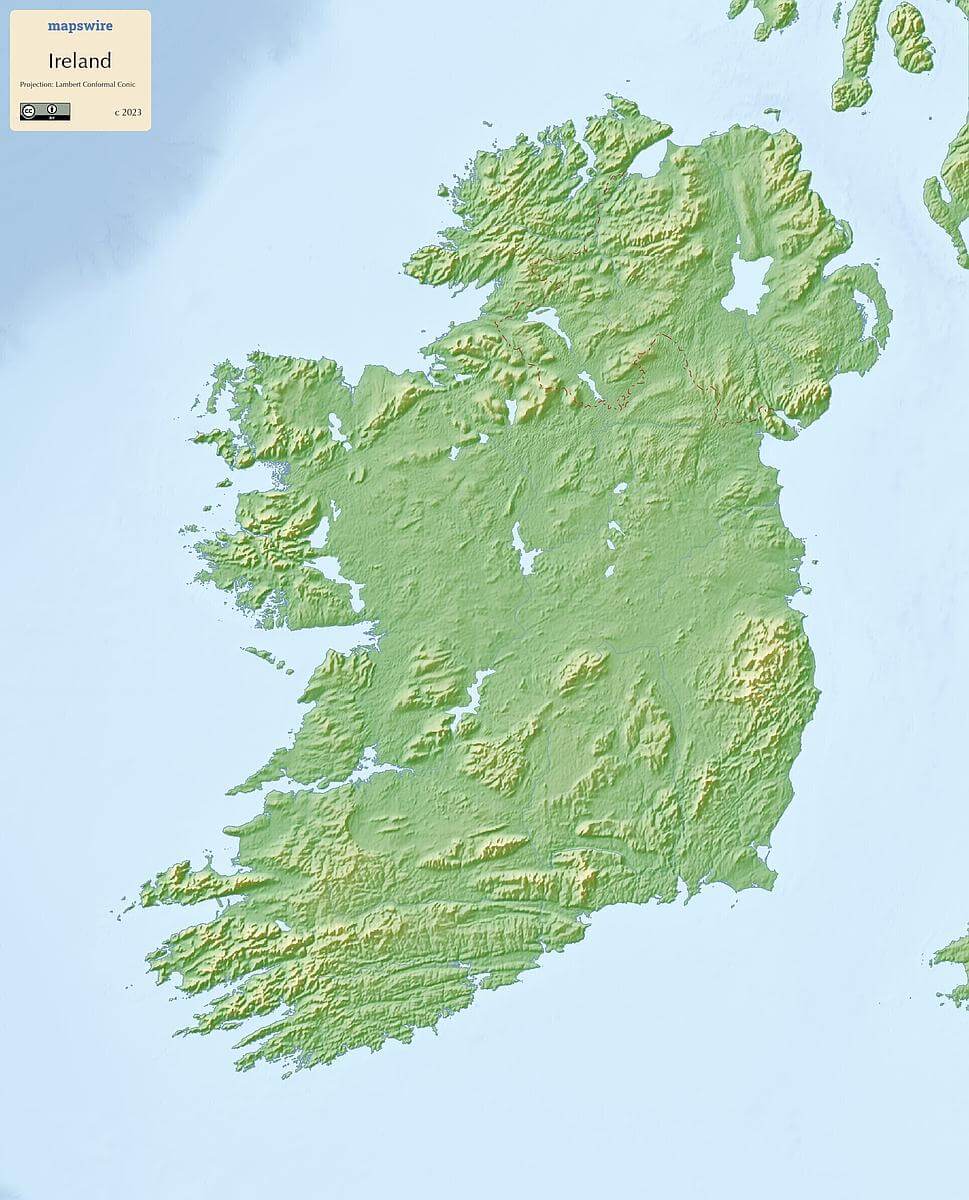
Free Maps of Ireland

Download six maps of Ireland for free on this page. The maps are provided under a Creative Commons (CC-BY 4.0) license. Use the "Download" button to get the largest image available.

A physical map of of Ireland (Projection: Lambert Conformal Conic)
Download
Informations of Ireland
Name Ireland
Capital Dublin
National holiday Saint Patrick's Day, 17 March; note - marks the traditional death date of Saint Patrick, patron saint of Ireland, during the latter half of the fifth century A.D. (most commonly cited years are c. 461 and c. 493); although Saint Patrick's feast day was celebrated in Ireland as early as the ninth century, it only became an official public holiday in Ireland in 1903
Population 5,275,004
Continent Europe
Subregion Northern Europe
Border countries UK 490 km

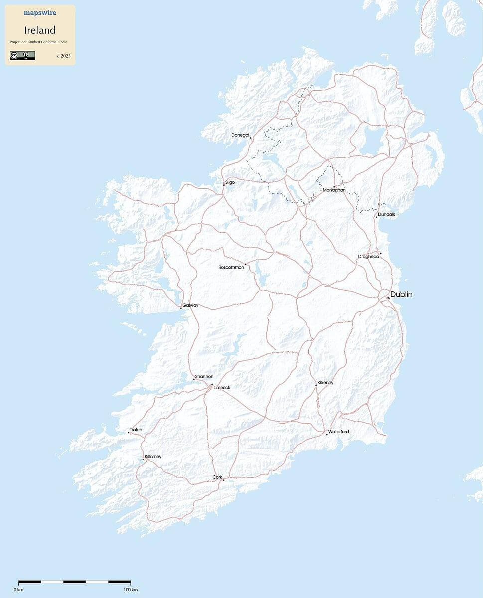
Physical Maps of Ireland

A physical map of of Ireland (Projection: Lambert Conformal Conic)
Download
A blank physical map of of Ireland (Projection: Lambert Conformal Conic)
Download

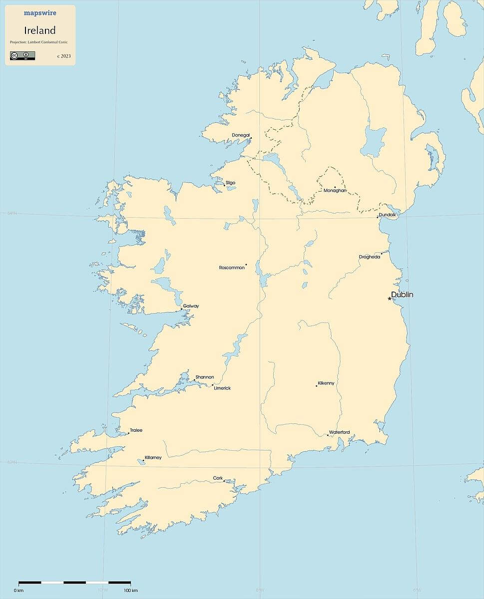
Printable Maps of Ireland

A printable map of of Ireland (Projection: Lambert Conformal Conic)
Download
A blank printable map of of Ireland (Projection: Lambert Conformal Conic)
Download

Other Maps of Ireland

A plain map of of Ireland (Projection: Lambert Conformal Conic)
Download

Where is Ireland located?

Where is Ireland located?
Location

Western Europe, occupying five-sixths of the island of Ireland in the North Atlantic Ocean, west of Great Britain

Download

Border countries:

United Kingdom

About Mapswire

Mapswire offers free maps of the world — covering all continents and a growing list of countries. Each map is licensed under Creative Commons, so you can use them freely in any project without paying license fees. For details on licensing and usage, see the FAQ.

As of Oct 27, 2025, Mapswire features 197 maps spanning all continents and 22 countries — and the collection keeps growing.

Ready for more?

Every two weeks, a new map that you can use, share, or just explore — beautifully made, data-driven.