Free Maps of Canada
Download six maps of Canada for free on this page. The maps are provided under a Creative Commons (CC-BY 4.0) license. Use the "Download" button to get the largest image available.
| Informations of Canada | |
|---|---|
| Name | Canada |
| Capital | Ottawa |
| National holiday | Canada Day, 1 July (1867) |
| Population | 38,232,593 |
| Continent | North America |
| Subregion | Northern America |
| Border countries | US 8,891 km (includes 2,475 km with Alaska) |
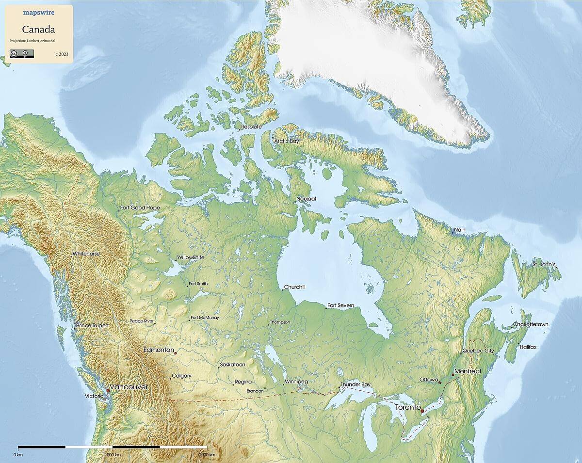
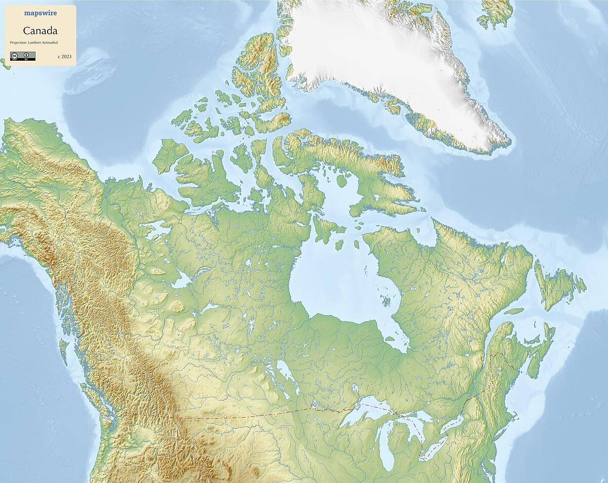
Physical Maps of Canada
Printable Maps of Canada
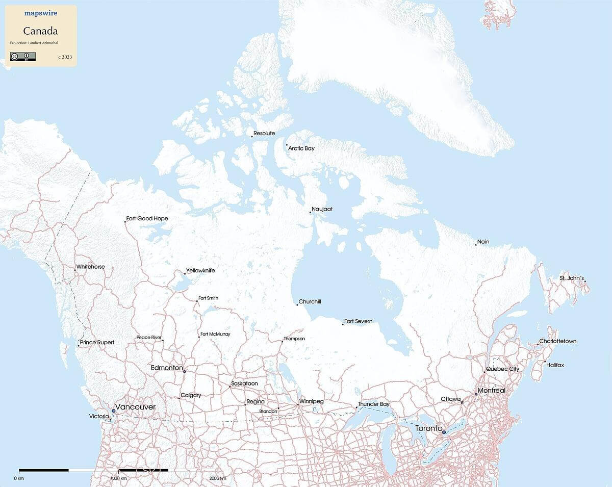
Other Maps of Canada
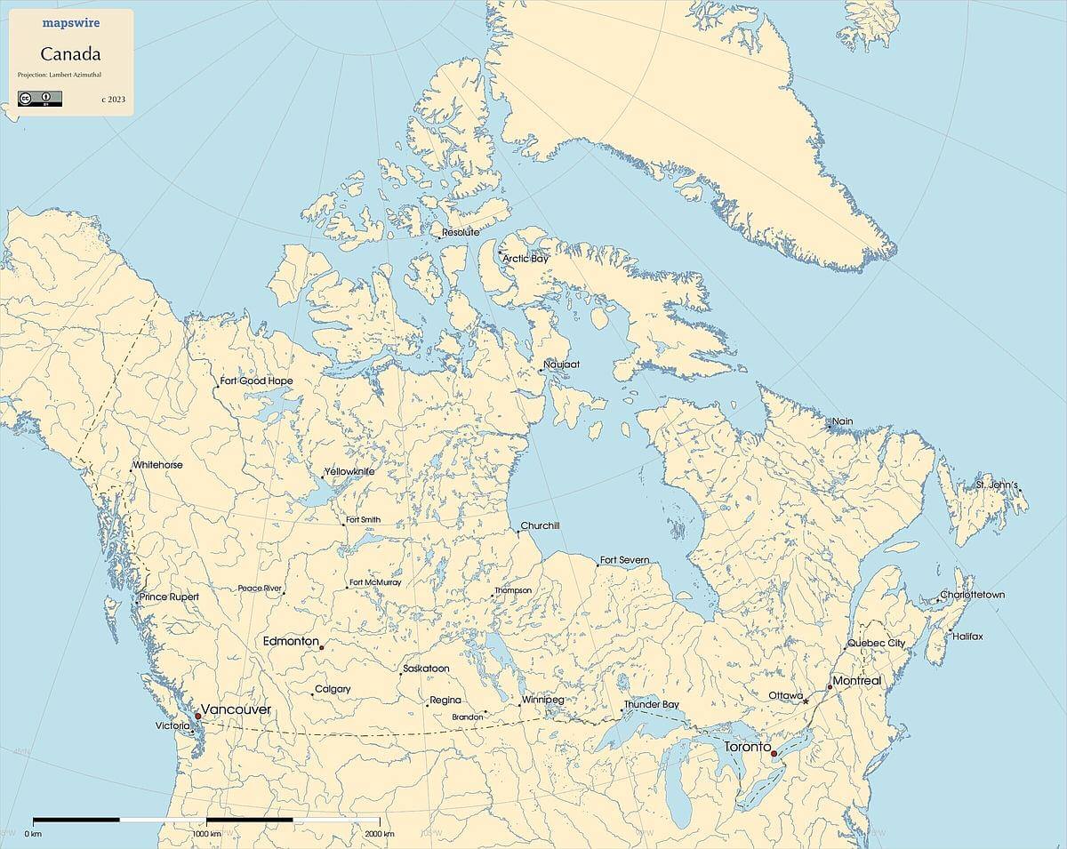
Where is Canada located?

Location
Northern North America, bordering the North Atlantic Ocean on the east, North Pacific Ocean on the west, and the Arctic Ocean on the north, north of the conterminous US
DownloadGeography of Canada
Mountain Ranges
The Canadian Rockies extend across western Canada, with iconic peaks like Mount Robson and Mount Columbia. The Coast Mountains run parallel to the Pacific coast, while the Appalachian Mountains are found in the eastern provinces.
Rivers and Lakes
The St. Lawrence River flows through eastern Canada, connecting the Great Lakes to the Atlantic Ocean. The Mackenzie River is the longest in Canada, flowing through the northern territories. The country is known for its vast freshwater bodies, including the Great Lakes and numerous other lakes such as Lake Superior, Lake Huron, and Lake Ontario.
Plains and Plateaus
The Canadian Prairies extend across the southern provinces, characterized by flat and fertile plains. The Interior Plains also cover parts of central Canada. The Columbia Icefield is a prominent plateau located in the Canadian Rockies.
Coastlines
Canada has extensive coastlines along the Atlantic Ocean, Pacific Ocean, and the Arctic Ocean. The rugged Atlantic Coast is dotted with fjords and bays, while the Pacific Coast features fjords, rainforests, and mountains.
Islands
The Canadian Arctic Archipelago is a collection of islands in the Arctic Ocean, including Baffin Island, the largest island in Canada. On the Pacific coast, Vancouver Island is known for its diverse ecosystems and natural beauty.
Tundra and Arctic Regions
Northern Canada is characterized by vast tundra and Arctic landscapes, with regions like the Canadian Shield and the Yukon Arctic Coast showcasing unique geological features.