Free Maps of France
Download six maps of France for free on this page. The maps are provided under a Creative Commons (CC-BY 4.0) license. Use the "Download" button to get the largest image available.
| Informations of France | |
|---|---|
| Name | French Republic |
| Capital | Paris |
| National holiday | Fete de la Federation, 14 July (1790); note - although often incorrectly referred to as Bastille Day, the celebration actually commemorates the holiday held on the first anniversary of the storming of the Bastille (on 14 July 1789) and the establishment of a constitutional monarchy; other names for the holiday are Fete Nationale (National Holiday) and quatorze juillet (14th of July) |
| Population | 68,305,148 |
| Continent | Europe |
| Subregion | Western Europe |
| Border countries | Andorra 55 km; Belgium 556 km; Germany 418 k; Italy 476 km; Luxembourg 69 km; Monaco 6 km; Spain 646 km; Switzerland 525 km |
Physical Maps of France

Printable Maps of France


Other Maps of France

Where is France located?
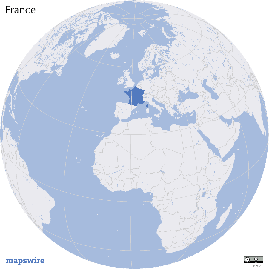
Location
metropolitan France: Western Europe, bordering the Bay of Biscay and English Channel, between Belgium and Spain, southeast of the UK; bordering the Mediterranean Sea, between Italy and Spain;
French Guiana: Northern South America, bordering the North Atlantic Ocean, between Brazil and Suriname;
Guadeloupe: Caribbean, islands between the Caribbean Sea and the North Atlantic Ocean, southeast of Puerto Rico;
Martinique: Caribbean, island between the Caribbean Sea and North Atlantic Ocean, north of Trinidad and Tobago;
Mayotte: Southern Indian Ocean, island in the Mozambique Channel, about halfway between northern Madagascar and northern Mozambique;
Reunion: Southern Africa, island in the Indian Ocean, east of Madagascar
DownloadGeography of France
Mountain Ranges
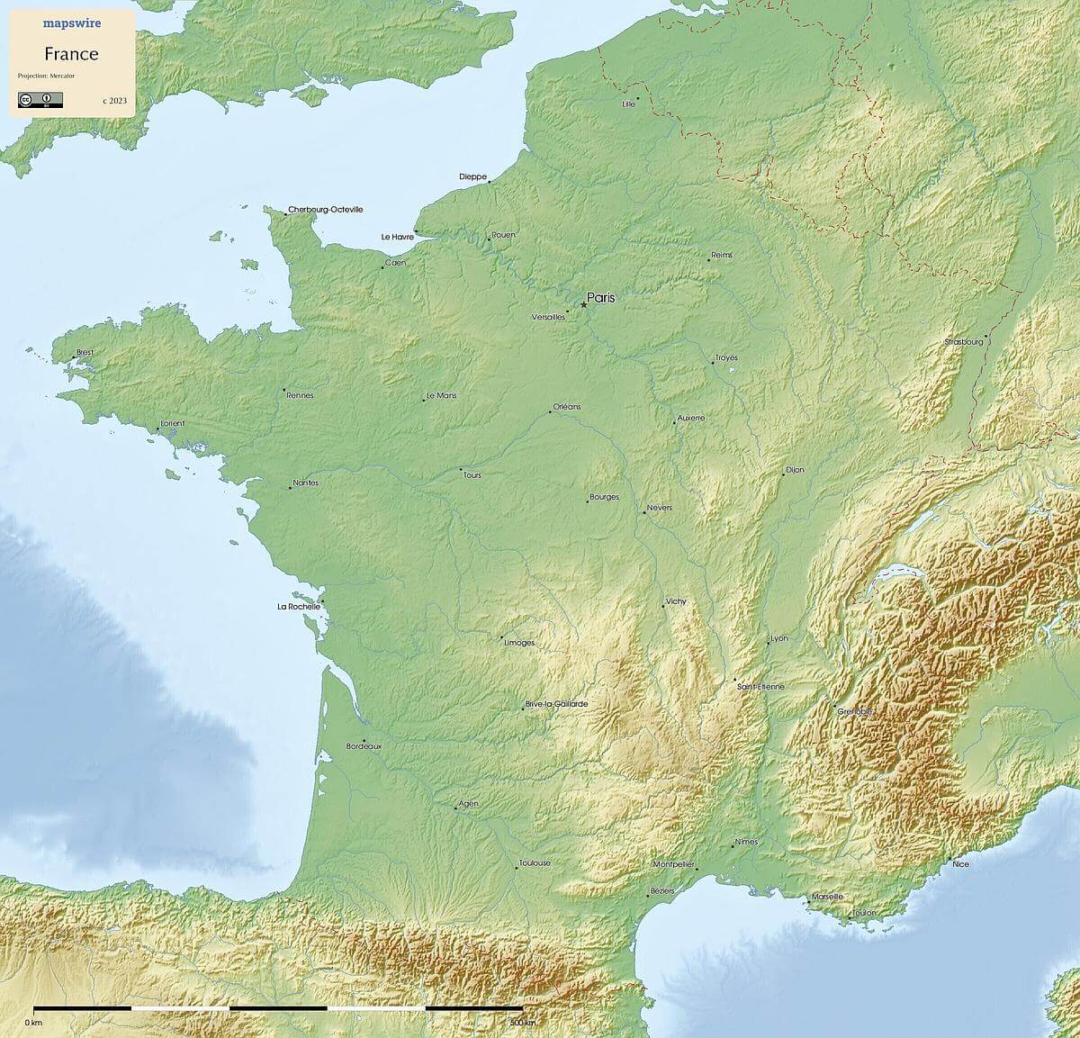
The Pyrenees form a natural border between France and Spain in the south, with peaks like Pic du Midi de Bigorre. In the southeast, the Alps extend across the border with Italy, culminating in Mont Blanc, Western Europe's highest peak. The Massif Central, a volcanic mountain range, occupies the central part of the country.
Rivers
The Seine River flows through the heart of Paris and northern France, while the Loire River runs through the central region. The Rhône River courses southward, passing through major cities like Lyon, before emptying into the Mediterranean Sea.
Plateaus and Plains
The Paris Basin, encompassing the northern part of France, is a fertile lowland with the city of Paris at its center. The Aquitanian Plain extends along the southwestern coast, and the Languedoc Plain lies between the Massif Central and the Pyrenees.
Coastlines
France is bordered by the Atlantic Ocean to the west, featuring diverse coastal formations like sandy beaches and rugged cliffs. To the south, the Mediterranean Coast offers picturesque beaches and iconic cities like Nice and Marseille.
Islands
Off the Atlantic coast, you'll find the Brittany Islands, including Île de Ré and Île d'Oléron. In the Mediterranean, Corsica stands out as a rugged and scenic island known for its unique culture and landscapes.
Lakes
Lake Geneva (Lac Léman) straddles the border between France and Switzerland in the Alps. Additionally, there are several artificial reservoirs and smaller lakes spread throughout the country.